General information:
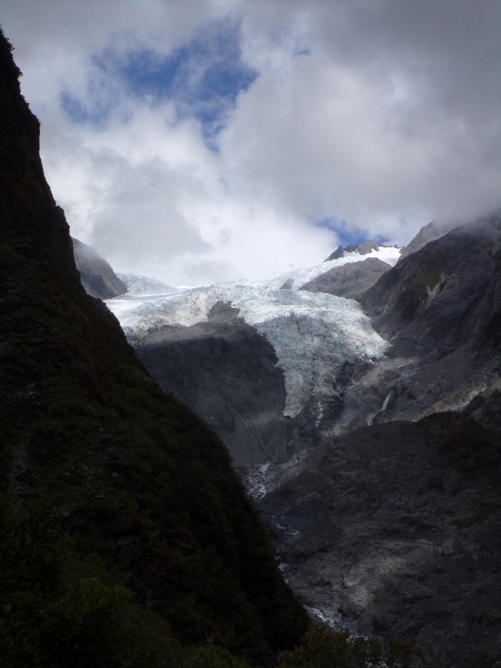
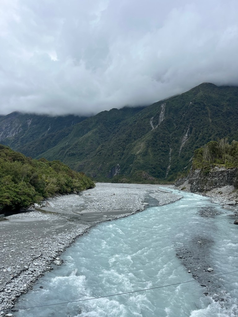
Franz Josef is a small town located on the west coast of New Zealand’s South Island. It is known for being home to the 12km long Franz Josef Glacier, one of the world’s fastest moving glaciers.
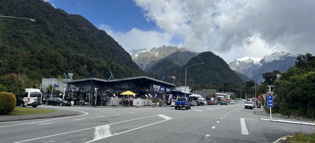
The Roberts Point track in Franz Josef is a 12.3km walk where you return along the same track. The walk begins in the Franz Josef car park, which is a 10 minute walk outside of Franz Josef. The hike takes you across multiple swing bridges over rivers, through lush forest and ends at a lookout with a stunning view of the glacier.
Know before you go:
- It is classed as a ‘challenging’ hike, with 650m of elevation, and you should only complete it if you have a moderate level of fitness. We were a bit apprehensive before the hike as we are not experienced hikers (and not overly fit!), and the DOC site about the walk preached caution. However, it was completely fine, we simply went slowly and took our time on the harder sections. In fact, this walk ended up being one of our favourites from our 3 months in New Zealand.
- The Franz Josef car park costs $5 an hour or $20 for the whole day, given the length of this hike the whole day should be paid for.
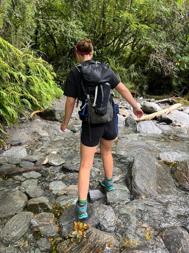
- The hike should only be attempted in good weather as there are a few stream crossings and slippery sections of the track. If you have them, I would definitely recommend wearing walking boots. I only had my trusty New Balance 530s which actually did the job pretty well, but more grip would have been helpful!
- Orange marker poles show you the correct route to take, and in most places are very easy to follow.
Packing list:
- Rucksack to carry everything
- At least 1 1/2 litres of water per person
- Lots of snacks!
- A packed lunch
- A camera
- Spare layers of clothing
- Shoes with good tread
Kilometre by Kilometre breakdown:
Kilometre 1:
The first kilometre is the easiest and will leave you wondering how this hike is meant to be ‘challenging’! It takes you from the car park where you can see the glacier from afar, over gravel paths and is almost completely flat. This was our quickest kilometre, taking only 14 minutes… if only all of them were this fast.
Kilometre 2:
At the beginning of this kilometre you come to the spectacular Peter’s Pool. The pool was formed approximately 200 years ago and is known as a ‘kettle lake’.
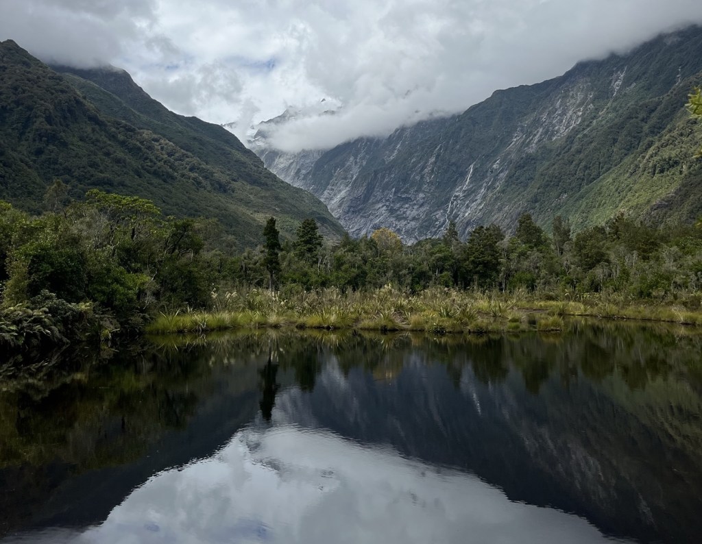
As the Franz Josef glacier retreated, it left behind a large block of ice. This ice was surrounded by glacial moraine, as the ice melted it created a depression in the moraine which filled with water, forming this kettle lake. The pools lead to great pictures (especially on a clearer day!) as you can see the reflections of the mountains in it.
The rest of the second kilometre is still quite straight forward and flat, until you get to the first stream crossing, where you can hop over the rocks and hopefully not get your feet wet! This is probably the deepest stream to cross, so if you’re fine over this one then you are likely going to be okay for the rest of the walk.
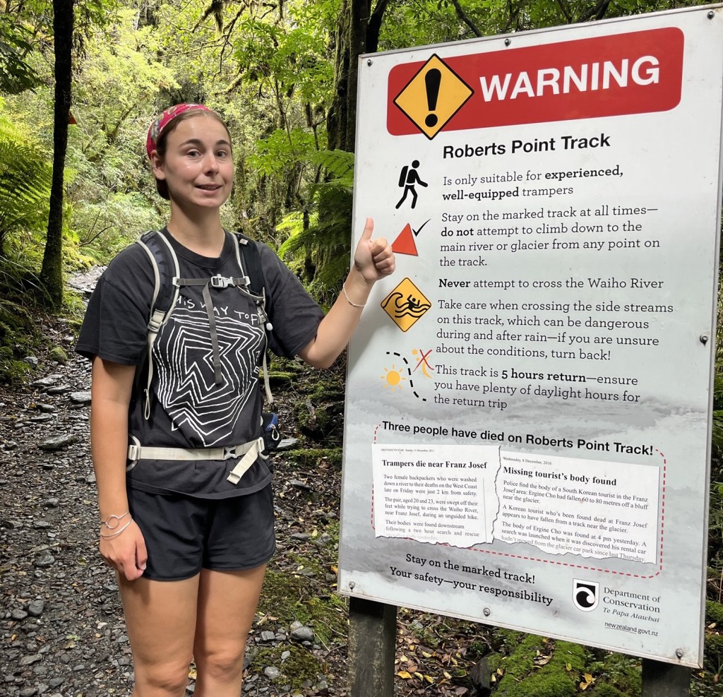
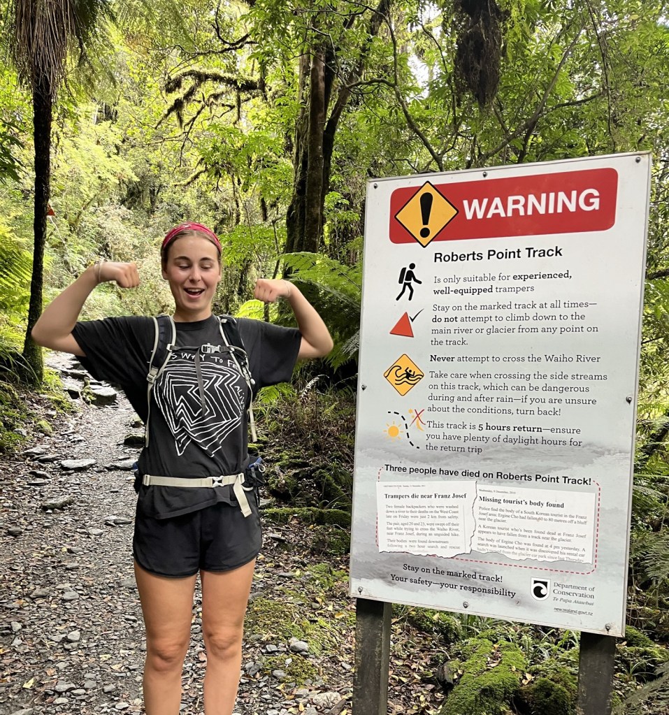
It always great before you do a walk to see that people have died on the track! But serves as a good reminder to always stay on the path.
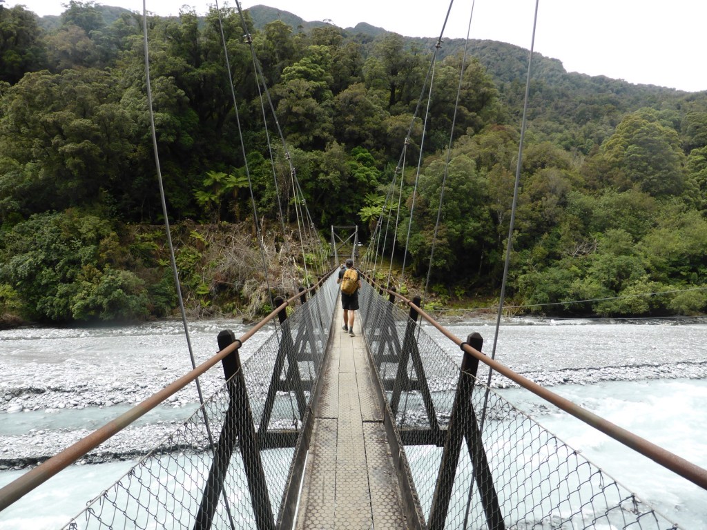
At the very end of the second kilometre you reach the Douglas bridge which crosses over the Waiho river. This is the official start of the Robert Point track and where the easy part of the walk ends I’m afraid! This kilometer took us 20 minutes, including breaks to stop and admire the views of course.
Kilometer 3:
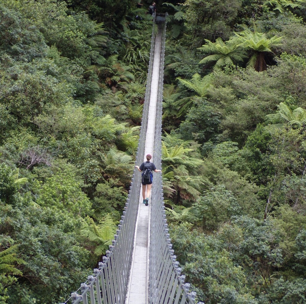
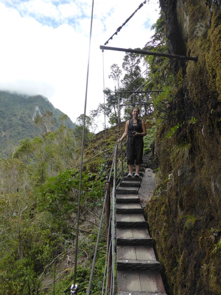
At the start of this kilometre is another suspension bridge, this one is even longer and shakier than the first one, but was one of our favourite parts of the walk. The Roberts Point swing bridge is over 100 metres long and is one of the most famous parts of this walk. We had to wait about 15 minutes to cross it as it is one-way, and then the people after us were taking lots of pictures so we felt bad going at the same time.
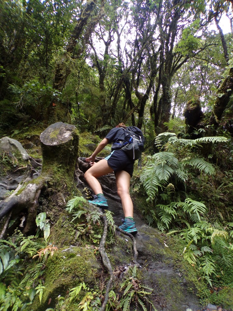
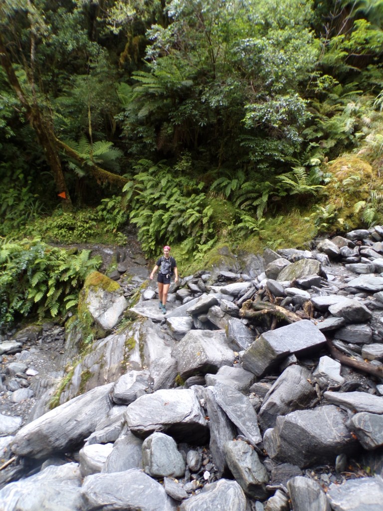
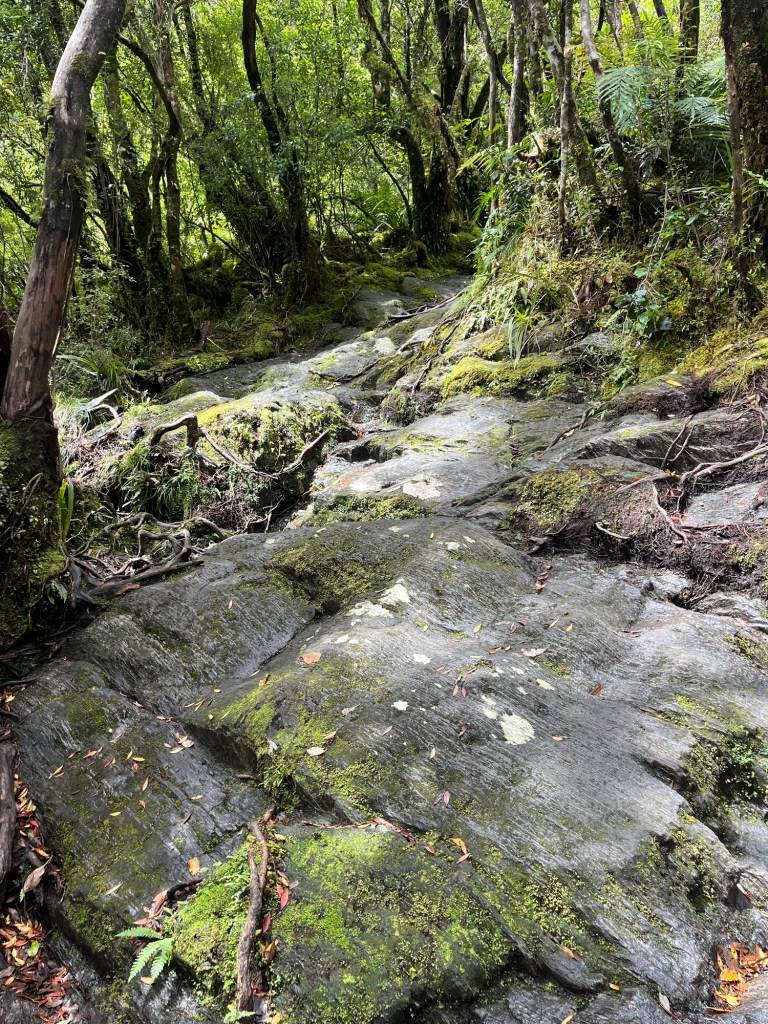
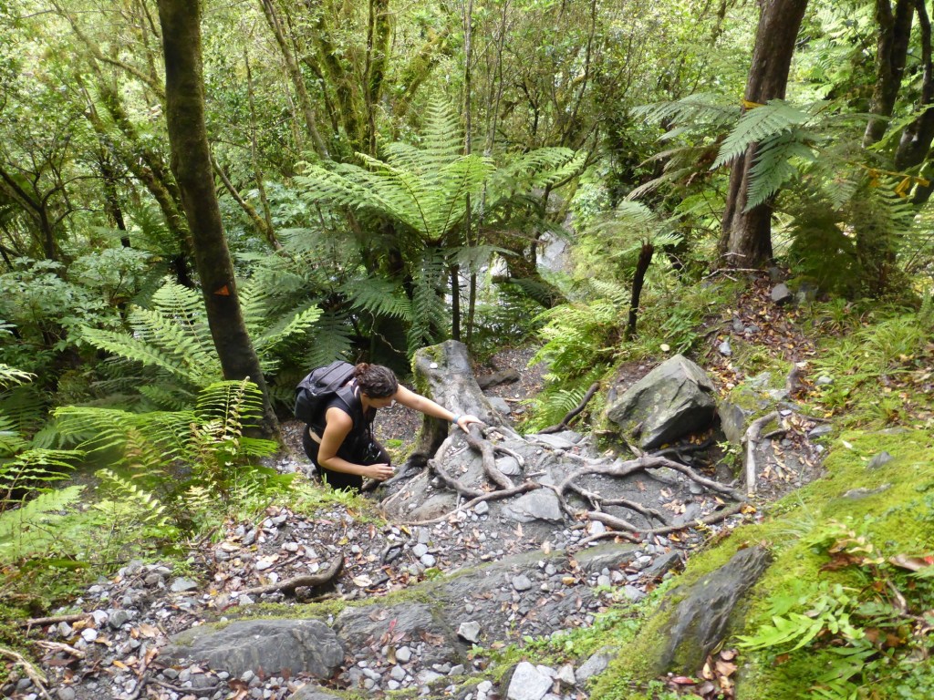
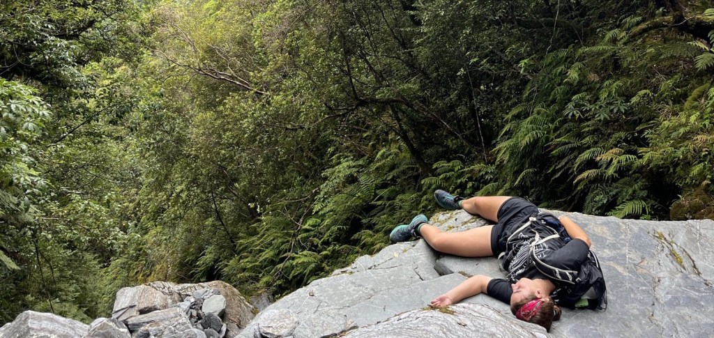
We met some people at this point who warned us how much harder the hike was about to get, and sadly they were right. The pictures below are from the rest of the third kilometre, where at certain points it was hard to follow the track because we couldn’t believe the arrows were pointing the correct way! There was lots of climbing over rocks, up steps and over tree roots, which made this kilometre take us 24 minutes in total.
Kilometre 4:
It was great to get to the start of the fourth kilometre and know that we were half way there. However, this was one of the trickiest ones and took us 33 minutes because so much of it was climbing rather than walking! We crossed over lots of streams and clambered up more rocks and tree roots, so progress was very slow but rewarding! We began to see why this track was a tramping track rather than just a walking one.
Halfway through this kilometre you reach Hendes hut, which was built in 1907 by Peter Hende while he was forming the wrought iron standards to support the Hende’s Gallery. Since then it has been used as a shelter by people walking the Roberts Point track.
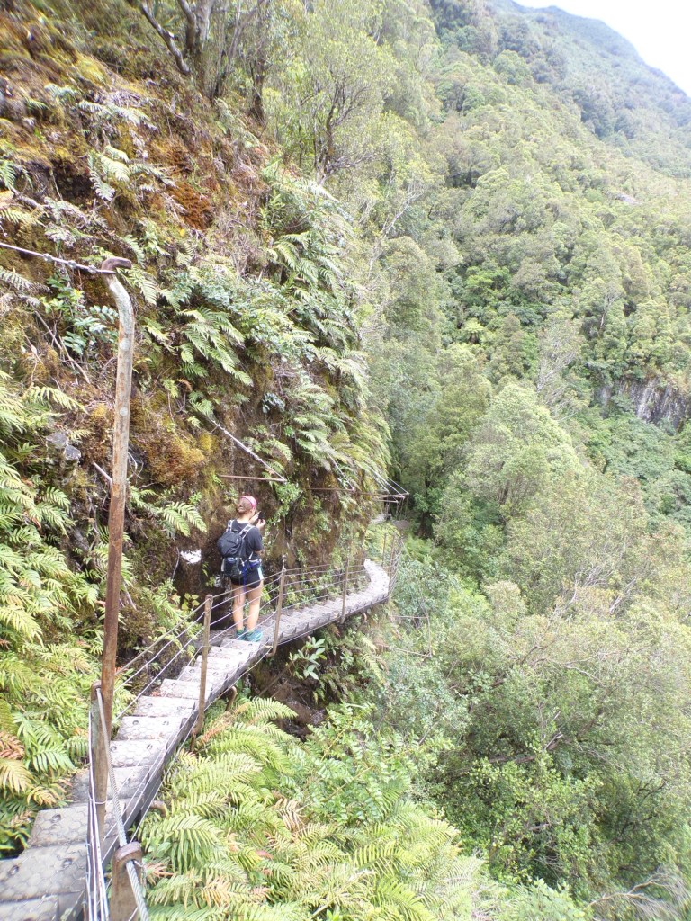
Hende’s gallery is the name given to the suspended steps which forms a small section of the track. Its original purpose was to give tourists a good view of the Franz Josef glacier, which has since retreated a few hundred metres. The lower section of the structure was swept away by an advance of the glacier in 1909, only 2 years after it was constructed. The present gallery was restored by the Department of Conservation in 1996.
At the end of this kilometre there are multiple stream crossings which are very slippery, so it is worth taking it slow and watching your step.
Kilometre 5:
This was our longest kilometre out of the entire walk and took us 38 minutes! It was extremely rocky and mostly vertical, so we included lots of water and tim-tam breaks! A lot of this section is one-way, and there were also a lot of people walking back from the viewpoint at this stage, so we spent quite a lot of time waiting for people to pass us before we could go ahead.
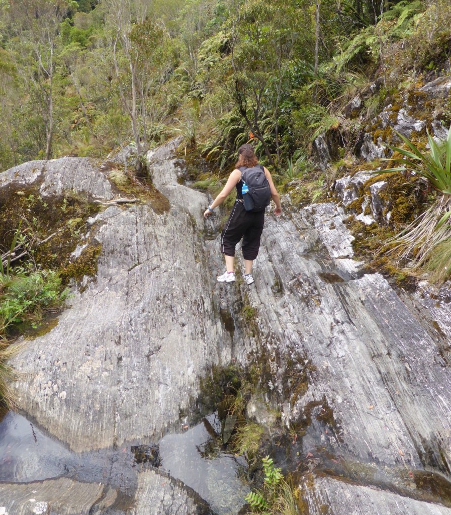
You definitely need to keep more of an eye out for the orange locator poles in this section as we went wrong on the way down again! This part really put the New Balance 530s to the test and was quite slippery.
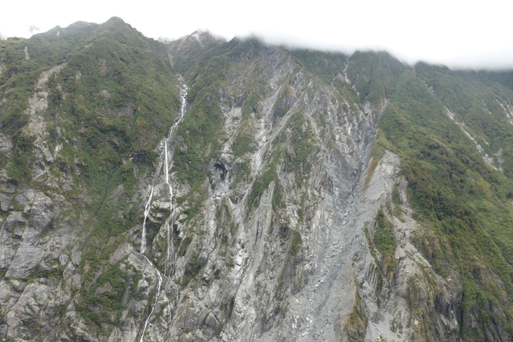
Kilometre 6:
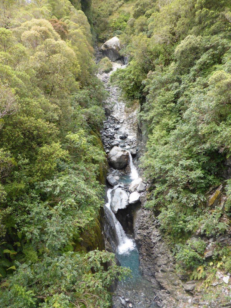
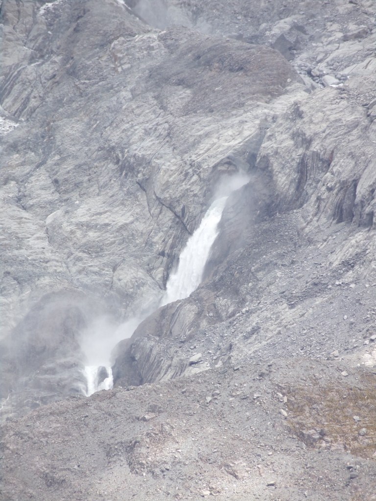
After this extremely rocky section you reach Rope Creek bridge which has views of this stunning waterfall. It is very high up though and I felt a bit ill looking over the edge!
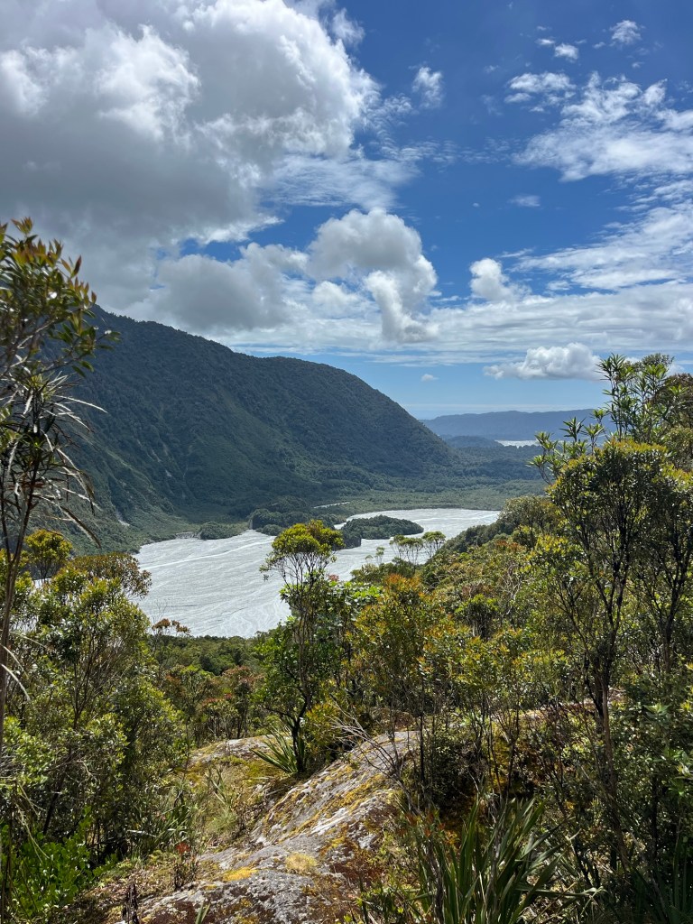
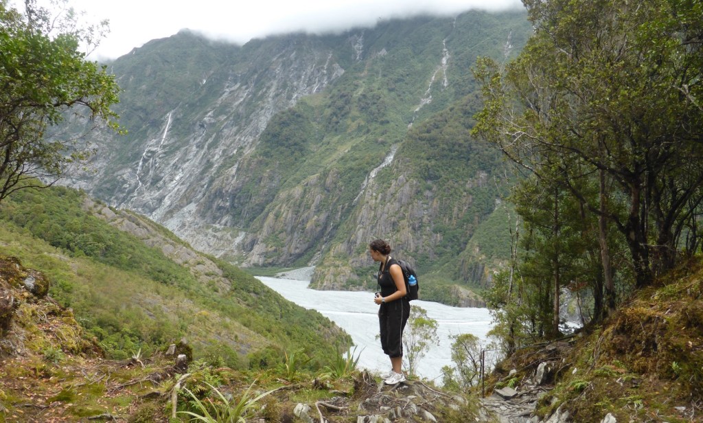
You also get to this lovely viewpoint over the valley where you can see how far you’ve come from which is great!
About 500m later we reached our destination, and straight away the view made the walk worth it! This last section involved some more climbing and stream crossings, but finally getting to the end makes it all worth it!
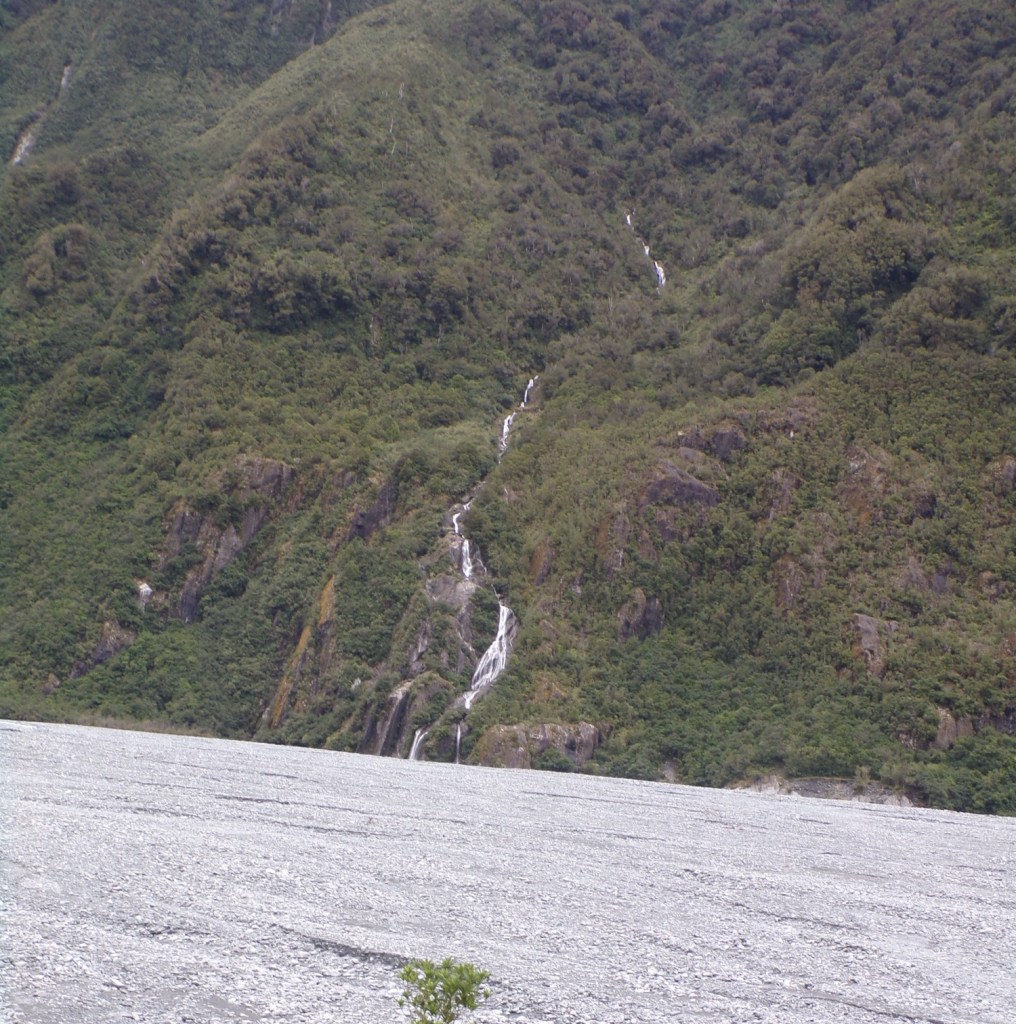
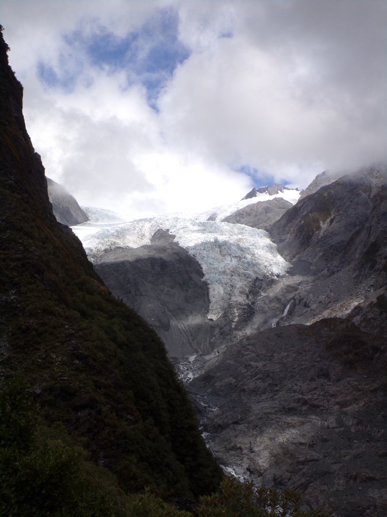
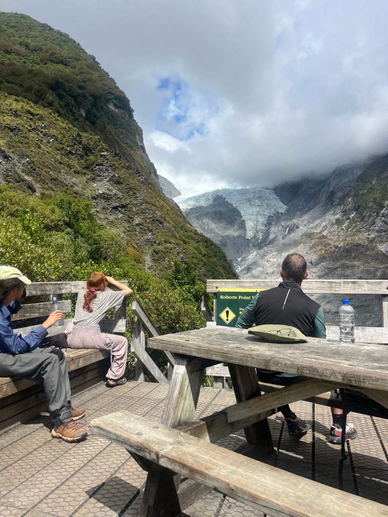
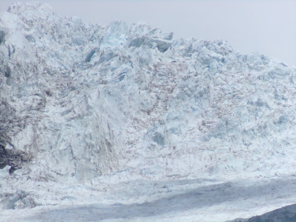
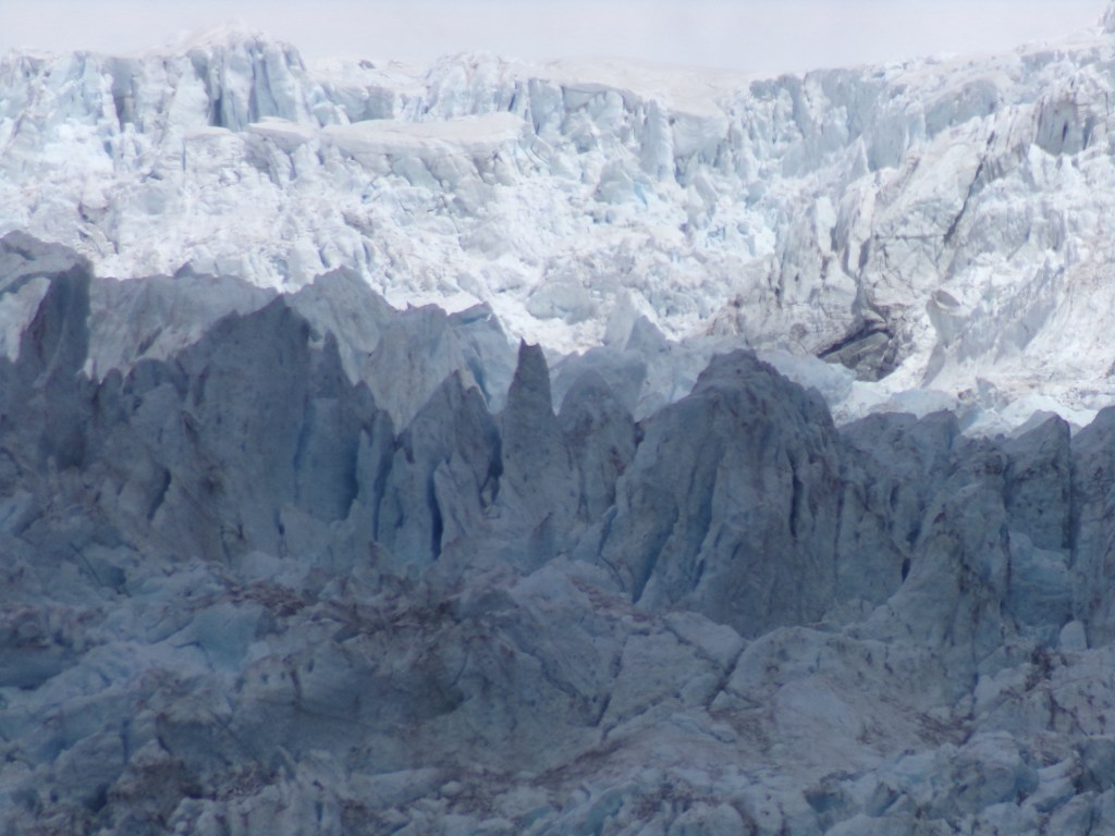
The Franz Josef Glacier view point:
We had started the walk at midday and got to the Robert Point viewpoint at about 3pm. The views of the glacier are absolutely stunning and this is the closest you can get to it on foot.
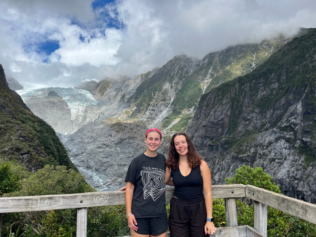
We ended up spending about 45 minutes at the viewpoint as we had a rest, ate our lunch and admired the glacier. We then got chatting to people and lost track of time a little bit, but it was a well-deserved break for sure! The lookout is a simple wooden structure with benches all around the edge and a picnic table in the middle.
We got fairly lucky with the weather, and as we had our lunch the clouds parted more, allowing us a clearer view of the glacier. It is very much a game of luck as to how good the view is because you can’t really see the glacier at all between the end of the second kilometre and the viewpoint, so you have no idea how good the view is until you emerge from the forest. Therefore, it is definitely best to check the weather forecast before you go to try and choose a sunny clear day, or allow yourself time at the viewpoint to wait and see if the view will improve.
The return walk
We started the walk back around 3:45pm and were a little apprehensive, as some parts were so vertical we thought we’d almost fall down the side! Happily, it ended up being far more manageable than we thought and was lot faster than the way there.
The first half of the return walk was still pretty slow as my inadequate shoes meant I had to be careful to avoid slipping. A lot of the rocks were covered in moss and wet from the surrounding streams, making it hard work as you had to be mindful where you put your feet at all times. However, it was still fun and a nice relief for our legs to not be going uphill anymore.

We were very relieved to reach Hende’s gallery again as this meant the hardest part of the return was over, however the steps were a lot harder to walk up than they were to go down!
On the way back it was also easier because it was later in the day, so we ran into less people passing us and didn’t have to wait for anyone.
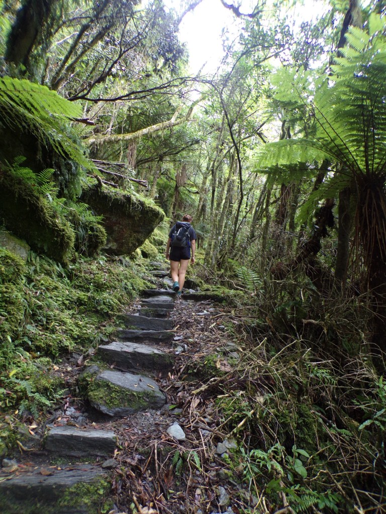
The last 3 kilometres were fairly easy, and to walk on a flat gravel path felt like an absolute luxury! As inexperienced hikers we were proud of how we had managed the hike, and would definitely recommend it to anyone, regardless of how much hiking practice they’d had.
We returned to the car park at 6pm, almost exactly 6 hours after we left. My apple watch measured about 4 hours 45 minutes of walking, the rest of the time was breaks throughout the walk and our lunch stop. We did about 20,000 steps and were very tired by the end of the day! My watch measured 657m of elevation and we felt every metre of it!
Thank you for reading this blog! If you enjoyed it, here are links to other New Zealand related blogs I have written 🙂
Tongariro Alpine Crossing Guide: What to expect and how to prepare
8 Incredible things to do in Arthur’s Pass National Park
Top 10 things to do in The Catlins (Complete Travel Guide)
Roy’s Peak Hike Guide: Everything you need to know before you go
The Ultimate Wanaka Guide: Top 10 things to do
10 Unmissable things to do in Queenstown for first-time visitors

Leave a comment